 1/14
1/14 Ski slopes Dachstein West – Gosau/Russbach/Annaberg
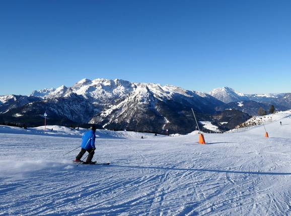
The Dachstein West ski area offers predominantly intermediate slopes. There are easy slopes at the practice lifts in the valley and also partly within the ski area. On the Zwieselalm, Riedlkopf, and Edtalm, you will also find difficult slopes. The slopes are generally quite wide and well integrated into the landscape. Forest trails lead to the valley stations in Gosau and Russbach, while you can carve your way down to Annaberg across wide alpine meadows.
With the 44 km long "Dachstein Tour" ski circuit, you are guaranteed panoramic skiing at its finest. The ski area is nestled between the Dachstein Glacier, Gosaukamm, and Tennengebirge. Throughout the entire ski area, you will find piste highlights and snow parks for both young and old.
Runs/slopes
Total: 51 km
| Easy | 15 km |
| Intermediate | 33 km |
| Difficult | 3 km |
Additional runs
| Ski routes | 4 km |
Worth knowing
- Artificial snow-making
314 Snow cannons - Valley run available
All villages in the Dachstein West ski area have snow-covered valley runs (Annaberg, Russbach, Gosau, and Gosau Hintertal).
Run location
- just above tree line
- under tree line
Longest run
- No. 1 Hornspitz-Russbach · Length 4.2 km · Elevation difference 741 m
Most difficult run
- No. 10b Donnergroll · Length 0.6 km · Elevation difference 152 m
Slope tip
- No. 1 Hornspitz-Russbach
- No. 9a valley run Zwieselalm
- No. 11 Riedlkar
Suggested routes through ski resort
- Ski Pleasure Circuit "Dachstein Tour": The 44 km long continuous circuit can be skied in both directions. Along the route, you will get to know the entire ski area along the Dachstein and pass through Gosau, Russbach, and Annaberg.
Snowparks
- Snow park/Fun park
- No halfpipe
Highlights
- Speed measurement course offered - free of charge
Jagaschuss Speed Check on slope 19 b in Annaberg - Public race course with time measurement - free of charge
Marcel Hirscher race track on slope 19 c in Annaberg - Skiline
Ski day reproduced in internet (Lifts used, elevation meters and slope kilometers skied) - free of charge
Towns/villages at the ski resort (distance from town center):
Annaberg im Lammertal (0.1 km), Russbach am Pass Gschütt (0.6 km), Gosau Towns/villages at the ski resort
Annaberg im Lammertal (0.1 km), Russbach am Pass Gschütt (0.6 km), Gosau Towns/villages at the ski resort
Feedback for the Skiresort.info Team? Please use this form
Book this ski resort
Test Reports
Tips for the ski holiday


