Ski resorts France
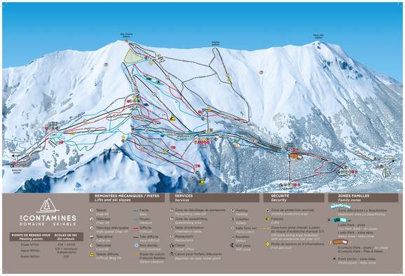
Trail map Les Contamines/Hauteluce Season 2024/2025
Interactive trail map
Towns/villages at the ski resort (distance from town center):
Les Contamines-Montjoie (1.6 km), Hauteluce (6 km), Le Lay (0.4 km), more Towns/villages at the ski resort more
Les Contamines-Montjoie (1.6 km), Hauteluce (6 km), Le Lay (0.4 km), more Towns/villages at the ski resort more
Feedback for the Skiresort.info Team? Please use this form »
Book this ski resort
Tips for the ski holiday


