Evaluated by Skiresort.info, the world's largest test portal for ski resorts.
The evaluation is done as follows
Orientation (Trail map, information boards, sign-postings) and safety in the ski resort Rinerhorn (Davos Klosters)
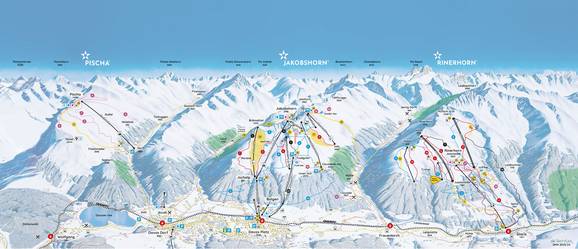
You can pick up paper trail maps everywhere in the resort. They contain information about the five ski resorts within Destination Davos Klosters. All slopes, lifts, mountain restaurants and the Rhaetian Railway information are included. There is also a separate schedule for the city buses and price information. The DavosKlostersSnow app assists with a built-in GPS tracker, which will help you find your way in the ski resort.
There are panorama maps at the mountain and base stations with current information. Each slope is marked in detail and it is possible to find your way even in very foggy conditions. There are large signs at all intersections with the slope numbers and where the slopes lead to.
Feedback for the Skiresort.info Team? Please use this form »


