Ski resorts Austria
Route planner
Access & on-site parking
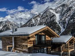
The villages of Serfaus, Fiss, and Ladis are located on a sunny plateau above the Upper Inn Valley in Tyrol. The ski area is easily accessible from the Inntal motorway, exit Reschen. From Ried in the Upper Inn Valley, mountain roads lead to Ladis, Fiss, and Serfaus. Day visitors can access the ski area at the Waldbahn or the Serfaus village subway. In Serfaus, the village subway takes you from the parking lot to the lifts, as the village is traffic-calmed. Parking in the Serfaus-Fiss-Ladis ski area is subject to a fee.Mobility on-site
- Comprehensive ski bus network
- Scheduled buses
- The Serfaus village subway runs from the parking lot on the outskirts of town to the cable car, stopping at the church and the village.
Access via A12 Inntal Motorway Innsbruck-Arlberg, exit Reschen (Oberinntal junction)
20 km Distance - approx. 19 Minutes driving time
Destination - Dorfstraße 52, 6532 Ladis, Austria
- Entry suitable for day visitors
- View on Google Maps
- usually enough available, tarmac car park
- for a fee
- Side road, Mountain road, well-developed
- Snow chains sometimes required by snowfall
- Road closure due to avalanches unlikely

23 km Distance - approx. 22 Minutes driving time
Destination - Fisser Straße 50, 6533 Fiss, Austria
- Ideal entry for day visitors
- View on Google Maps
- enough available, tarmac car park, gravel car park
- for a fee, € 6,- / per day
- Side road, Mountain road, well-developed
- Snow chains sometimes required by snowfall
- Road closure due to avalanches unlikely

23 km Distance - approx. 23 Minutes driving time
Destination - Seilbahnstraße 44, 6533 Fiss, Austria
- Entry suitable for day visitors
- View on Google Maps
- usually enough available, tarmac car park
- for a fee
- Side road, Mountain road, well-developed
- Snow chains sometimes required by snowfall
- Road closure due to avalanches unlikely

25 km Distance - approx. 24 Minutes driving time
Destination - Dorfbahnstraße 1, 6534 Serfaus, Austria
- Entry suitable for day visitors
- View on Google Maps
- enough available, covered car park, tarmac car park
- for a fee, € 6,- / per day
- Side road, Mountain road, well-developed
- Snow chains sometimes required by snowfall
- Road closure due to avalanches unlikely

More Entry point(s) to the ski resort
Destination
- Mühlbachweg, 6534 Serfaus, Austria
- View on Google Maps
- none

 Access to ski resort
  Town/village close to ski resort
  Traffic Junction
 All information is supplied without guarantee
The maps are provided by Google with the following information: „These directions are for planning purposes only. You may find that construction projects, traffic, weather, or other events may cause conditions to differ from the map results, and you should plan your route accordingly. You must obey all signs or notices regarding your route.“
Feedback for the Skiresort.info Team? Please use this form

Tips for the ski holiday
Test Reports


