Ski resorts Switzerland

Route planner
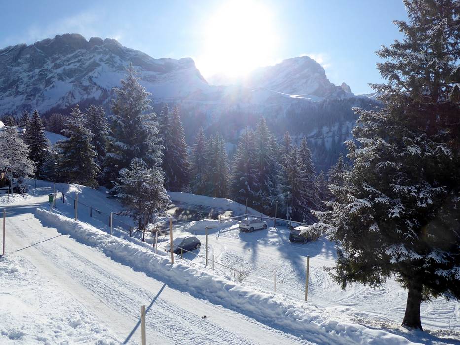
Access & on-site parking
The Villars/Gryon/Les Diablerets ski resort is located in the canton of Vaud. Mountain roads lead from the Rhone Valley up to Villars, Gryon and Les Diablerets. Payable parking is available at all entry points. Anyone travelling by train can change to the BVB (Bex-Villars-Bretaye) cog railway directly in Bex to very easily continue to Villars and then up into the ski region. Winter Closure
The Col de la Croix is closed in winter. It is therefore not possible to drive directly from Villars to Les Diablerets in winter. The route is always via Aigle.
Access via
- A9 Autoroute du Rhône, Ausfahrt Aigle
16 km approx. 23 min » - A8 Spiez-Interlaken, Exit Spiez
74 km approx. 81 min » - A9 Autoroute du Rhône, Ausfahrt Bex
15 km approx. 22 min »
Mobility on-site
- Ski buses
- Scheduled buses
- Public buses run in the individual villages and the BVB Bex-Villars-Bretaye cog railway provides the connection from the valley to Villars and into the ski resort.
Access via A9 Autoroute du Rhône, Ausfahrt Aigle
16 km Distance - approx. 23 Minutes driving time
Destination - Chemin des Drus, 1884 Villars sur Ollon, Switzerland
- Entry suitable for day visitors
- View on Google Maps
- usually enough available, tarmac car park
- for a fee
- Mountain road, well-developed, with significant incline
- Snow chains sometimes required by snowfall
- Road closure due to avalanches unlikely

23 km Distance - approx. 30 Minutes driving time
Destination - Route du Col de la Croix, Les Diablerets, 1865 Ormont-Dessus, Switzerland
- Ideal entry for day visitors
- View on Google Maps
- usually enough available, tarmac car park, gravel car park
- for a fee
- Mountain road, well-developed, with significant incline
- Snow chains sometimes required by snowfall
- Road closure due to avalanches sometimes possible

Access via A8 Spiez-Interlaken, Exit Spiez
74 km Distance - approx. 81 Minutes driving time
Destination - Route du Col de la Croix, Les Diablerets, 1865 Ormont-Dessus, Switzerland
- Ideal entry for day visitors
- View on Google Maps
- usually enough available, tarmac car park, gravel car park
- for a fee
- Mountain road, well-developed, with significant incline
- Snow chains sometimes required by snowfall
- Road closure due to avalanches sometimes possible
Access via A9 Autoroute du Rhône, Ausfahrt Bex
15 km Distance - approx. 22 Minutes driving time
Destination - Batterie Télécabine, Route de Solalex 31, 1882 Gryon, Switzerland
- Ideal entry for day visitors
- View on Google Maps
- limited amount available, tarmac car park
- for a fee
- Mountain road, well-developed, with significant incline
- Snow chains sometimes required by snowfall
- Road closure due to avalanches unlikely

More Entry point(s) to the ski resort
Destination
- Pl. de la Gare, 1884 Villars-sur-Ollon, Switzerland
- Entry suitable for day visitors
- View on Google Maps
- limited amount available, covered car park
- for a fee

Destination
- Chemin de Bretaye, Bretaye, 1884 Ollon, Switzerland
- View on Google Maps
- none

Destination
- Chemin des Fracherets, 1882 Gryon, Switzerland
- Entry suitable for day visitors
- View on Google Maps
- limited amount available
Destination
- Pl. de la Gare, 1880 Bex, Switzerland
- View on Google Maps
- limited amount available, covered car park, tarmac car park
- for a fee
 Access to ski resort
  Town/village close to ski resort
  Traffic Junction
 All information is supplied without guarantee
The maps are provided by Google with the following information: „These directions are for planning purposes only. You may find that construction projects, traffic, weather, or other events may cause conditions to differ from the map results, and you should plan your route accordingly. You must obey all signs or notices regarding your route.“
Feedback for the Skiresort.info Team? Please use this form »
Book this ski resort

Tips for the ski holiday

")

